VRGeoscience Ltd develop 3D technology to better understand deep underground structures
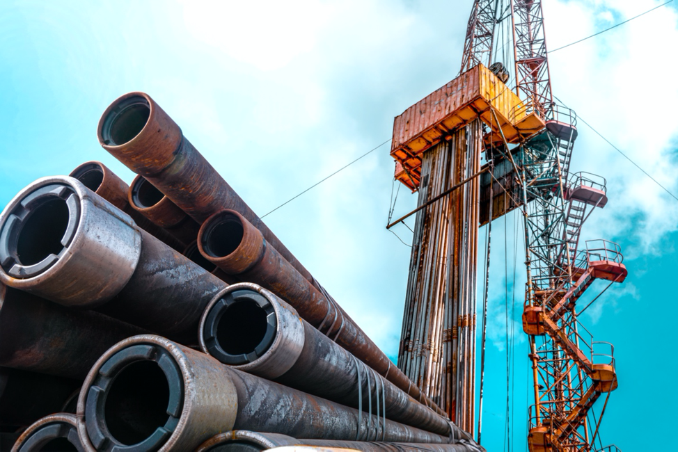
Geoscientists and engineers often need to make decisions based on very limited datasets and the costs of getting it wrong can be significant. In the oil industry, reducing the risks of misinterpreting the geological structures in a reservoir can run into tens of millions of pounds and the benefits of improving a well’s productivity can make the difference between a healthy profit or a significant loss.
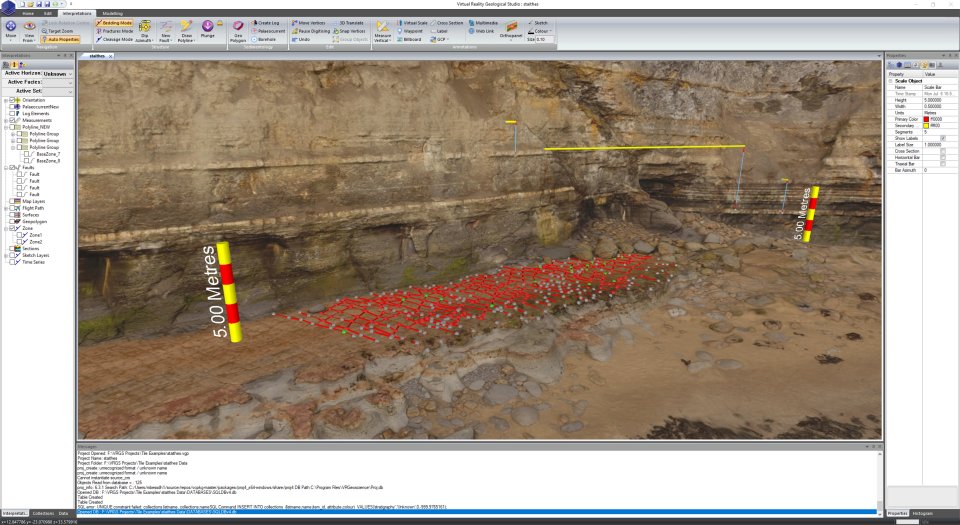
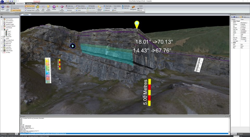
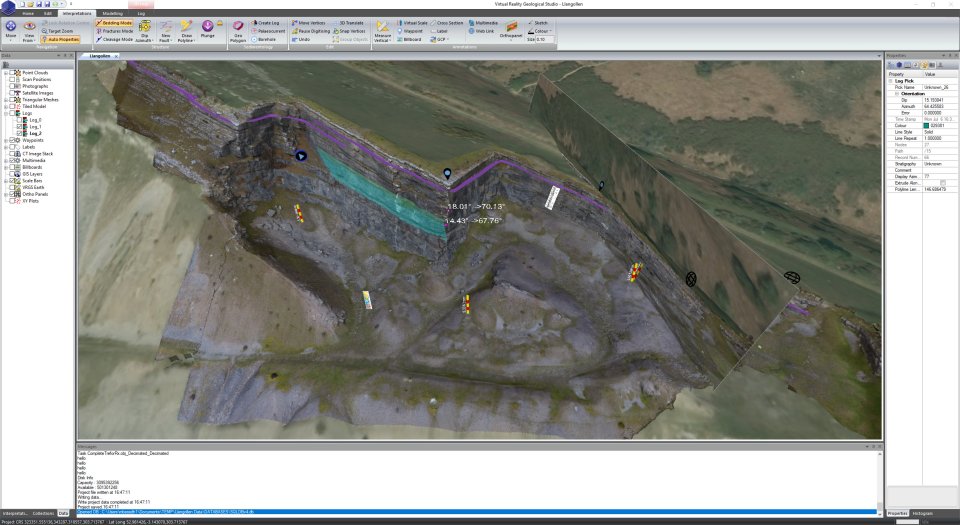
VRGeoscience’s Virtual Reality Geological Studio (VRGS) is a 3D data visualisation and interpretation software tool that uses captured data from LiDAR, Structure from Motion (SFM), DEM or any other point cloud type dataset to create useful digital models of the surface outcrop formations.
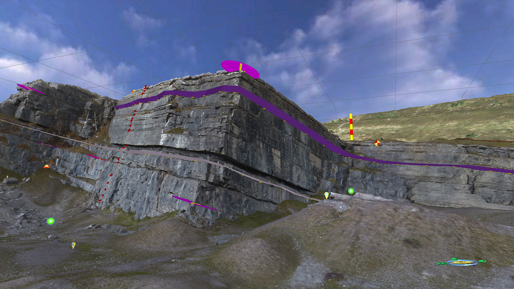
Using this data and VRGS’s analytical tools geologists and engineers can extrapolate information on geological heterogeneity allowing far more accurate understanding of the form and porosity of subsurface formations.
Interpretation tools include structural measurement (dip/azimuth) of faults and beds, polylines and geobodies, with associated analysis of these data types with stereonets and statistical output.
Developed over the last 15 years by Dr Dave Hodgetts from The University of Manchester’s Department of Earth Environmental Sciences VRGeoscience’s VRGS software is already being used by some of the world’s largest oil companies and leading academic institutions. It is believed that VRGS is currently the most advanced digital outcrop modelling system available.
Dave comments: “VRGS’s ability to improve our understanding of subsurface structures will significantly reduce risk and increase productivity in a wide range of exploration, mining, hydrogeological and civil engineering applications. The new business will be able to offer VRGS software packages and training and consultancy services. For larger customers we will also be able to offer customised software packages which address their individual needs”.
VRGS Features Include:
- Visualisation of large data sets with ultra-high resolution texture maps (100’s of megapixels) in 3D with very high frame rates
- Import from a broad spectrum of data formats (additional formats added on request) including PLY and OBJ.
- Processing and attribute analysis of both point cloud and mesh data.
- Filtering and classification of mesh and point cloud data.
- Easy to use interpretation tools for bedding, faults and fractures and other features.
- Mapping of geobodies and integration of sedimentological data, such as palaoecurrents, into the geobody.
- Stereonet and histogram analysis of data.
- Addition to scale bars, measurements and other annotations to models.
- Create animations and fly-throughs via built in movie tools.
- Image draping and projective texturing.
- Easy export of data to ASCII text files.
- Support for Oculus Rift Headsets allowing you to visit your field localities in VR and transition between VR and desktop model seamlessly.